
Chapter 16
Navigation
Any specific geographical point can be located by reference to its longitude and latitude. Washington, D.C., for example, is approximately 39° N latitude, 77° W longitude. Chicago is approximately 42° N latitude, 88° W longitude.
Time Zones
The meridians are also useful for designating time zones. A day is defined as the time required for the Earth to make one complete rotation of 360°. Since the day is divided into 24 hours, the Earth revolves at the rate of 15° an hour. Noon is the time when the sun is directly above a meridian; to the west of that meridian is morning, to the east is afternoon.
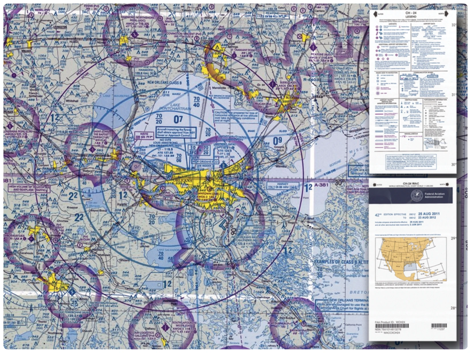
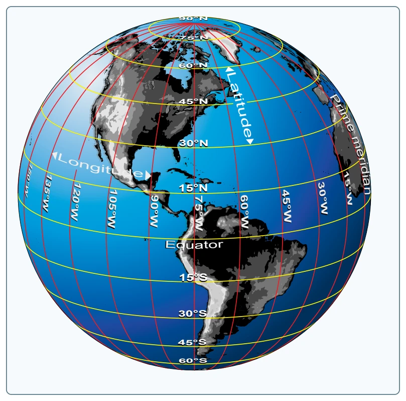
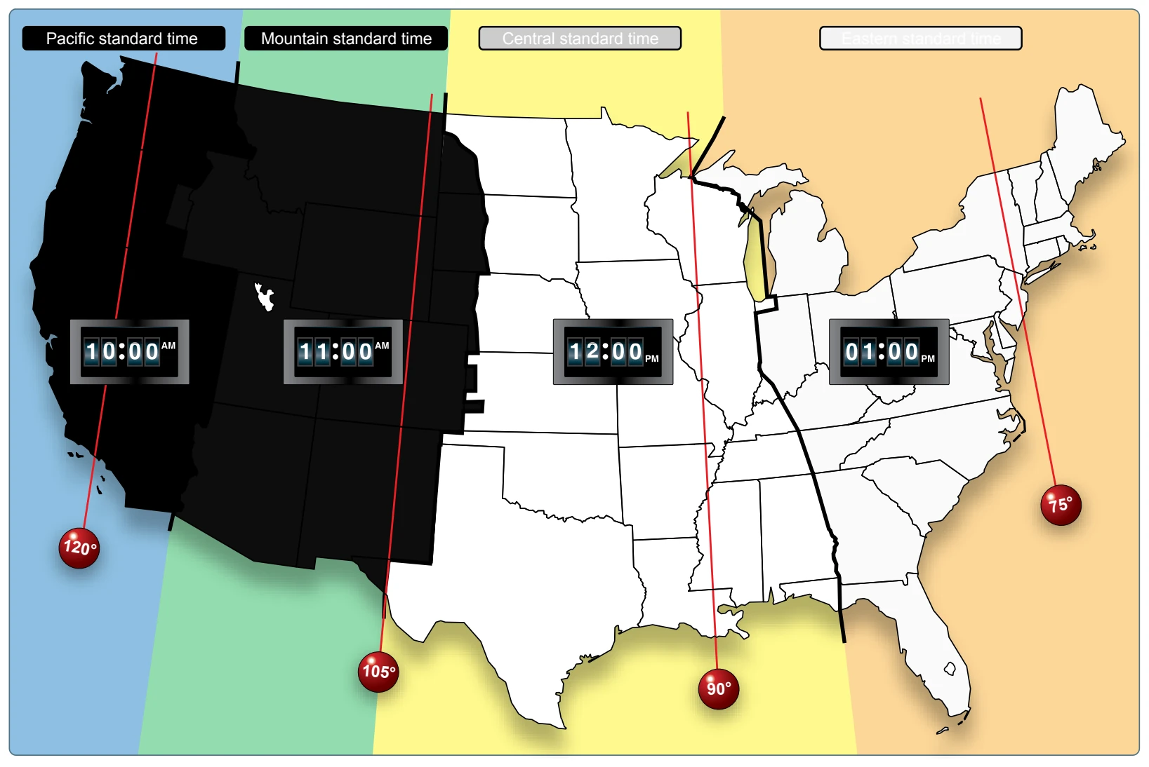
The standard practice is to establish a time zone for each 15° of longitude. This makes a difference of exactly 1 hour between each zone. In the conterminous United States, there are four time zones. The time zones are Eastern (75°), Central (90°), Mountain (105°), and Pacific (120°). The dividing lines are somewhat irregular because communities near the boundaries often find it more convenient to use time designations of neighboring communities or trade centers.
States. When the sun is directly above the 90th meridian, it is noon Central Standard Time. At the same time, it is 1 p.m. Eastern Standard Time, 11 a.m. Mountain Standard Time, and 10 a.m. Pacific Standard Time. When Daylight Saving Time is in effect, generally between the second Sunday in March and the first Sunday in November, the sun is directly above the 75th meridian at noon, Central Daylight Time.
These time zone differences must be taken into account during long flights eastward-especially if the flight must be completed before dark. Remember, an hour is lost when
flying eastward from one time zone to another, or perhaps even when flying from the western edge to the eastern edge of the same time zone. Determine the time of sunset at the destination by consulting the flight service station (FSS) and take this into account when planning an eastbound flight.
In most aviation operations, time is expressed in terms of the 24-hour clock. ATC instructions, weather reports and broadcasts, and estimated times of arrival are all based on this system. For example: 9 a.m. is expressed as 0900, 1 p.m. is 1300, and 10 p.m. is 2200.
Because a pilot may cross several time zones during a flight, a standard time system has been adopted. It is called Universal Coordinated Time (UTC) and is often referred to as Zulu time. UTC is the time at the 0° line of longitude which passes through Greenwich, England. All of the time zones around the world are based on this reference. To convert to this time, a pilot should do the following: Eastern Standard Time..........Add 5 hours
Central Standard Time..........Add 6 hours Mountain Standard Time.......Add 7 hours Pacific Standard Time...........Add 8 hours For Daylight Saving Time, 1 hour should be subtracted from the calculated times.
Measurement of Direction
By using the meridians, direction from one point to another can be measured in degrees, in a clockwise direction from true north. To indicate a course to be followed in flight, draw a line on the chart from the point of departure to the destination and measure the angle that this line forms with a meridian. Direction is expressed in degrees, as shown by the compass rose in Figure 16-6.
Because meridians converge toward the poles, course measurement should be taken at a meridian near the midpoint of the course rather than at the point of departure. The course measured on the chart is known as the true course (TC). This is the direction measured by reference to a meridian or true north (TN). It is the direction of intended flight as measured in degrees clockwise from TN.
As shown in Figure 16-7, the direction from A to B would be a TC of 065°, whereas the return trip (called the reciprocal) would be a TC of 245°.
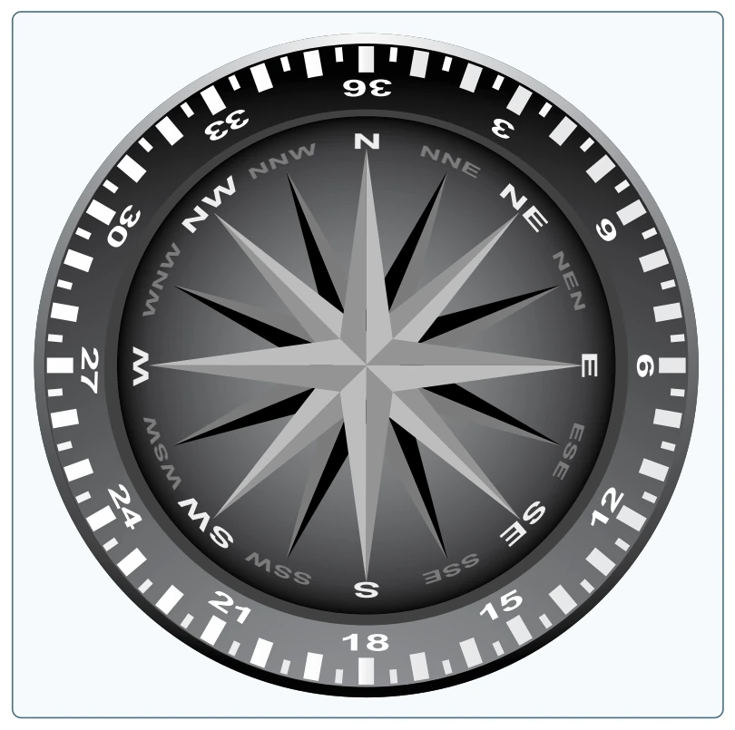
The true heading (TH) is the direction in which the nose of the aircraft points during a flight when measured in degrees clockwise from TN. Usually, it is necessary to head the aircraft in a direction slightly different from the TC to offset the effect of wind. Consequently, numerical value of the TH may not correspond with that of the TC. This is discussed more fully in subsequent sections in this chapter. For the purpose of this discussion, assume a no-wind condition exists under which heading and course would coincide. Thus, for a TC of 065°, the TH would be 065°. To use the compass accurately, however, corrections must be made for magnetic variation and compass deviation.