
Chapter 12
Weather Theory
The relationship between dew point and temperature defines the concept of relative humidity. The dew point, given in degrees, is the temperature at which the air can hold no more moisture. When the temperature of the air is reduced to the dew point, the air is completely saturated and moisture begins to condense out of the air in the form of fog, dew, frost, clouds, rain, or snow.
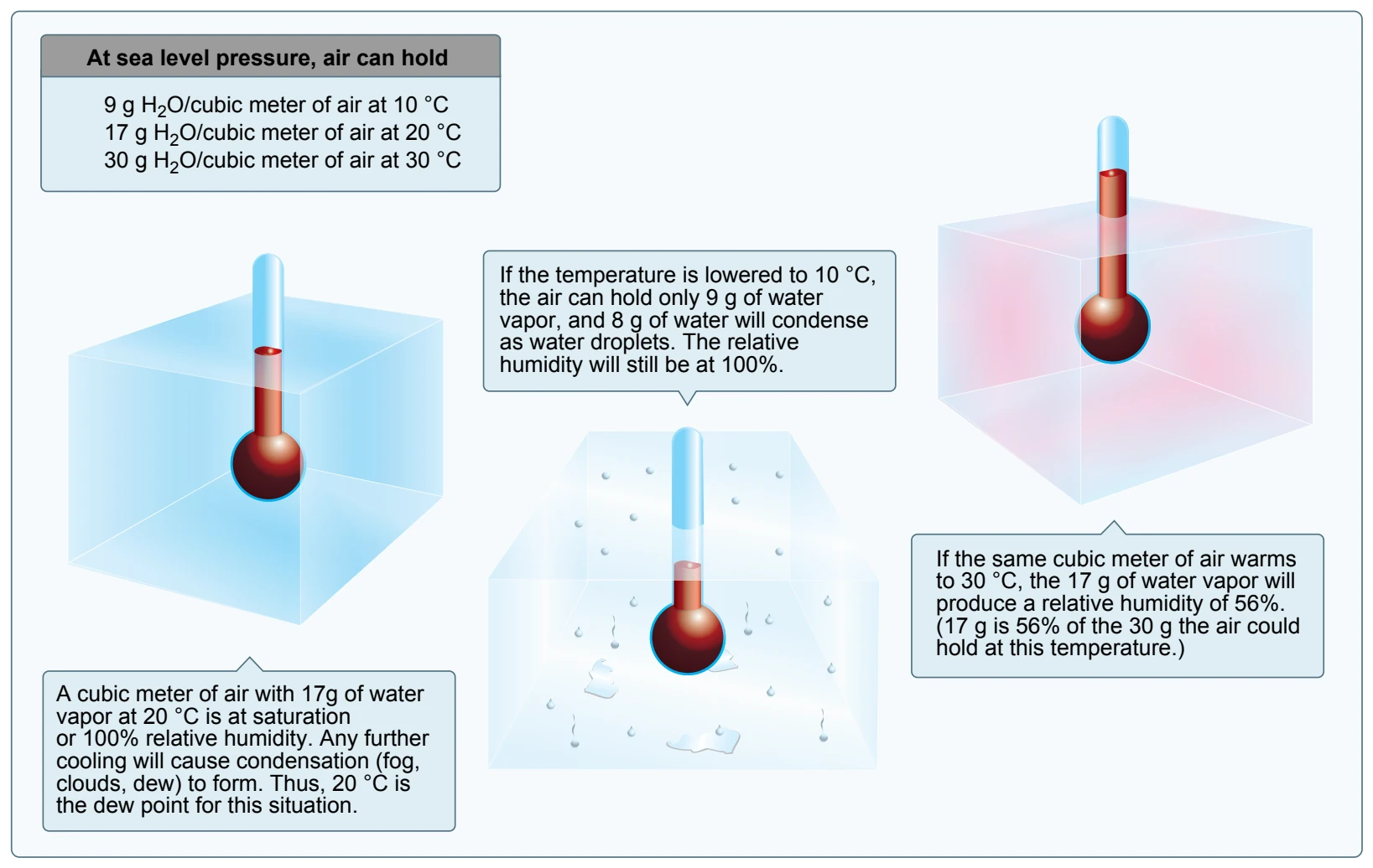
As moist, unstable air rises, clouds often form at the altitude where temperature and dew point reach the same value. When lifted, unsaturated air cools at a rate of 5.4 °F per 1,000 feet and the dew point temperature decreases at a rate of 1 °F per 1,000 feet. This results in a convergence of temperature and dew point at a rate of 4.4 °F. Apply the convergence rate to the reported temperature and dew point to determine the height of the cloud base.
Given: Temperature (T) = 85 °F Dew point (DP) = 71 °F Convergence Rate (CR) = 4.4° T - DP = Temperature Dew Point Spread (TDS) TDS ÷ CR = X X × 1,000 feet = height of cloud base AGL Example: 85 °F - 71 °F = 14 °F 14 °F ÷ 4.4 °F = 3.18 3.18 × 1,000 = 3,180 feet AGL The height of the cloud base is 3,180 feet AGL.
Explanation: With an outside air temperature (OAT) of 85 °F at the surface and dew point at the surface of 71 °F, the spread is 14°. Divide the temperature dew point spread by the convergence rate of 4.4 °F, and multiply by 1,000 to determine the approximate height of the cloud base.
Methods by Which Air Reaches the Saturation Point
If air reaches the saturation point while temperature and dew point are close together, it is highly likely that fog, low clouds, and precipitation will form. There are four methods by which air can reach the saturation point. First, when warm air moves over a cold surface, the air temperature drops and reaches the saturation point. Second, the saturation point may be reached when cold air and warm air mix. Third, when air cools at night through contact with the cooler ground, air reaches its saturation point. The fourth method occurs when air is lifted or is forced upward in the atmosphere.
As air rises, it uses heat energy to expand. As a result, the rising air loses heat rapidly. Unsaturated air loses heat at a rate of 3.0 °C (5.4 °F) for every 1,000 feet of altitude gain. No matter what causes the air to reach its saturation point, saturated air brings clouds, rain, and other critical weather situations.
Dew and Frost
On cool, clear, calm nights, the temperature of the ground and objects on the surface can cause temperatures of the surrounding air to drop below the dew point. When this occurs, the moisture in the air condenses and deposits itself on the ground, buildings, and other objects like cars and aircraft. This moisture is known as dew and sometimes can be seen on grass and other objects in the morning. If the temperature is below freezing, the moisture is deposited in the form of frost. While dew poses no threat to an aircraft, frost poses a definite flight safety hazard. Frost disrupts the flow of air over the wing and can drastically reduce the production of lift. It also increases drag, which when combined with lowered lift production, can adversely affect the ability to take off. An aircraft must be thoroughly cleaned and free of frost prior to beginning a flight.
Fog
Fog is a cloud that is on the surface. It typically occurs when the temperature of air near the ground is cooled to the air’s dew point. At this point, water vapor in the air condenses and becomes visible in the form of fog. Fog is classified according to the manner in which it forms and is dependent upon the current temperature and the amount of water vapor in the air.
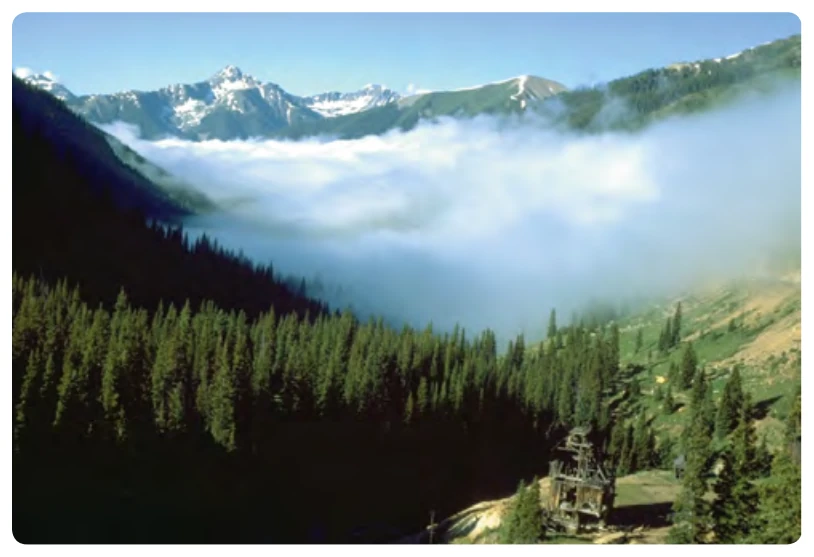
On clear nights, with relatively little to no wind present, radiation fog may develop. [Figure 12-21] Usually, it forms in low-lying areas like mountain valleys. This type of fog occurs when the ground cools rapidly due to terrestrial radiation, and the surrounding air temperature reaches its dew point. As the sun rises and the temperature increases, radiation fog lifts and eventually burns off. Any increase in wind also speeds the dissipation of radiation fog. If radiation fog is less than 20 feet thick, it is known as ground fog.
When a layer of warm, moist air moves over a cold surface, advection fog is likely to occur. Unlike radiation fog, wind is required to form advection fog. Winds of up to 15 knots
allow the fog to form and intensify; above a speed of 15 knots, the fog usually lifts and forms low stratus clouds. Advection fog is common in coastal areas where sea breezes can blow the air over cooler landmasses.
Upslope fog occurs when moist, stable air is forced up sloping land features like a mountain range. This type of fog also requires wind for formation and continued existence. Upslope and advection fog, unlike radiation fog, may not burn off with the morning sun but instead can persist for days. They can also extend to greater heights than radiation fog.
Steam fog, or sea smoke, forms when cold, dry air moves over warm water. As the water evaporates, it rises and resembles smoke. This type of fog is common over bodies of water during the coldest times of the year. Low-level turbulence and icing are commonly associated with steam fog.
Ice fog occurs in cold weather when the temperature is much below freezing and water vapor forms directly into ice crystals. Conditions favorable for its formation are the same as for radiation fog except for cold temperature, usually -25 °F or colder. It occurs mostly in the arctic regions but is not unknown in middle latitudes during the cold season.